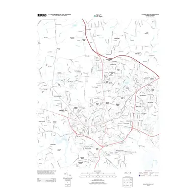
2013 Map of Chapel Hill
USGS Topo · Published 2013About this map
University Lake and the winding course of Morgan Cr anchor the southern landscape of this 2013 survey of the Piedmont region. The map reveals a dense suburban and institutional network surrounding the educational heart of the area, characterized by named residential developments like Glen Lennox and Kensington Trace. Topographic landmarks provide significant local context, from the elevated peak of Blackwood Mountain in the north to the industrial history implied by Iron Mine Hill. Transportation and utility infrastructure are well-documented, featuring multiple aviation sites such as Horace Williams Airport and Womble Field Airport. The map also captures several distinct water features, including the poetically named Meeting of the Waters near Greenwood, illustrating the complex drainage patterns of Bolin Cr and its tributaries as they move through the undulating terrain of Mount Bolus and McCauley Mount.
Find a feature on this map
104 named features on this map. Tap any name to fly to it.
Don’t see what you’re looking for? This feature index may not catch every label — zoom into the map to look around manually.
Map Details
Editions of this 2013 Chapel Hill Map
This is the sole edition of this map. No revisions or reprints were ever made.
Other maps of this area

1943 · Durham South
USGS Topo · 1:62,500

1946 · Chapel Hill
USGS Topo · 1:24,000

1947 · Chapel Hill
USGS Topo · 1:31,680

1951 · Farrington
USGS Topo · 1:24,000

1951 · Durham South
USGS Topo · 1:62,500

1951 · Durham North
USGS Topo · 1:62,500

1953 · Raleigh
USGS Topo · 1:250,000

1953 · Greensboro
USGS Topo · 1:250,000

1954 · Greensboro
USGS Topo · 1:250,000

1954 · Raleigh
USGS Topo · 1:250,000