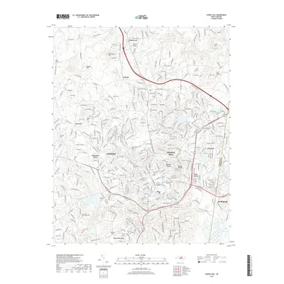
2019 Map of Chapel Hill
USGS Topo · Published 2019About this map
The Univ of N Carolina at Chapel Hill campus serves as the cultural and geographic anchor for this region, surrounded by a dense network of neighborhoods including Tenney Circle, Glen Lennox, and Carrboro. The landscape is defined by its transition from urban academic centers to the wooded ridges of Blackwood Mtn and Iron Mine Hill. Significant water features like University Lake and the Morgan Creek drainage system dictate the local topography, while numerous small cemeteries such as the Old Chapel Hill Cem and Barbee - Hargraves Cem provide deep genealogical connections to the area's early families. The transition from the developed core of Chapel Hill to outlying settlements like Eubanks and Blackwood illustrates the suburban expansion and preserved natural spaces that characterize this part of the North Carolina Piedmont.
Find a feature on this map
367 named features on this map. Tap any name to fly to it.
Don’t see what you’re looking for? This feature index may not catch every label — zoom into the map to look around manually.
Map Details
Editions of this 2019 Chapel Hill Map
This is the sole edition of this map. No revisions or reprints were ever made.
Other maps of this area

1943 · Durham South
USGS Topo · 1:62,500

1946 · Chapel Hill
USGS Topo · 1:24,000

1947 · Chapel Hill
USGS Topo · 1:31,680

1951 · Farrington
USGS Topo · 1:24,000

1951 · Durham South
USGS Topo · 1:62,500

1951 · Durham North
USGS Topo · 1:62,500

1953 · Raleigh
USGS Topo · 1:250,000

1953 · Greensboro
USGS Topo · 1:250,000

1954 · Greensboro
USGS Topo · 1:250,000

1954 · Raleigh
USGS Topo · 1:250,000