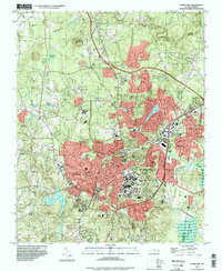
1993 Map of Chapel Hill
USGS Topo · Published 1998About this map
University of North Carolina and the sprawling campus of Chapel Hill dominate the southeastern quadrant of this late-century landscape. The map captures the dense urban core extending into Carrboro and residential neighborhoods like Glen Lennox and Briarcliff. Infrastructure critical to the university town’s operations is clearly marked, from the Horace Williams Airport to the Hospital and Kenan Stadium.
Find a feature on this map
66 named features on this map. Tap any name to fly to it.
Don’t see what you’re looking for? This feature index may not catch every label — zoom into the map to look around manually.
Map Details
Editions of this 1993 Chapel Hill Map
This is the sole edition of this map. No revisions or reprints were ever made.
Other maps of this area

1943 · Durham South
USGS Topo · 1:62,500

1946 · Chapel Hill
USGS Topo · 1:24,000

1947 · Chapel Hill
USGS Topo · 1:31,680

1951 · Farrington
USGS Topo · 1:24,000

1951 · Durham South
USGS Topo · 1:62,500

1951 · Durham North
USGS Topo · 1:62,500

1953 · Raleigh
USGS Topo · 1:250,000

1953 · Greensboro
USGS Topo · 1:250,000

1954 · Greensboro
USGS Topo · 1:250,000

1954 · Raleigh
USGS Topo · 1:250,000