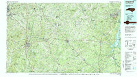
1984 Map of Chapel Hill
USGS Topo · Published 1985About this map
B. Everett Jordan Lake dominates the eastern corner of this landscape, a significant reservoir marking the confluence of the Haw River and other tributaries. To the southwest, the Uwharrie National Forest and the Uwharrie Mountains create a distinct topographical contrast to the Piedmont plains, punctuated by peaks such as Coolers Knob Mtn and Cedar Rock Mountain. This mid-1980s data shows the development of the N C Zoological Park near Asheboro, reflecting the region's mid-century shift toward conservation and tourism.
Find a feature on this map
73 named features on this map. Tap any name to fly to it.
Don’t see what you’re looking for? This feature index may not catch every label — zoom into the map to look around manually.
Map Details
Editions of this 1984 Chapel Hill Map
This is the sole edition of this map. No revisions or reprints were ever made.
Other maps of this area

1942 · Troy
USGS Topo · 1:125,000

1943 · Durham South
USGS Topo · 1:62,500

1946 · Chapel Hill
USGS Topo · 1:24,000

1947 · Chapel Hill
USGS Topo · 1:31,680

1949 · High Point West
USGS Topo · 1:24,000

1950 · High Point East
USGS Topo · 1:24,000

1951 · High Point East
USGS Topo · 1:24,000

1951 · Guilford
USGS Topo · 1:24,000

1951 · Fair Grove
USGS Topo · 1:24,000

1951 · Farrington
USGS Topo · 1:24,000