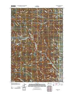
2011 Map of Chapman
USGS Topo · Published 2011About this map
Scappoose serves as the primary hub in this Columbia County landscape, situated at the confluence of diverse waterways and timber history. The presence of the Crown Zellerbach Logging Rd underscores the region's historical reliance on forestry, winding through the terrain toward Spitzenberg and Chapman. Small settlements like Apple Valley and Yankton are connected by a web of rural routes such as Dutch Canyon Rd and Bunker Hill Rd, reflecting a dispersed residential pattern common to the Oregon Coast Range foothills. Water management is a central theme, evidenced by features like the James O Fisher Reservoir, Sherman Reservoir Number Two, and Heinen Pond. For genealogists, the Yankton-Hillcrest Cemetery and the Scappoose Post Office provide fixed points for tracing local family history and community development in this transition zone between the valley floor and the wooded ridges of Bald Hill and Strawberry Ridge.
Find a feature on this map
94 named features on this map. Tap any name to fly to it.
Don’t see what you’re looking for? This feature index may not catch every label — zoom into the map to look around manually.
Map Details
Editions of this 2011 Chapman Map
This is the sole edition of this map. No revisions or reprints were ever made.
Other maps of this area

1915 · Hillsboro
USGS Topo · 1:62,500

1918 · Hillsboro
USGS Topo · 1:62,500

1922 · St. Helens
USGS Topo · 1:62,500

1940 · Hillsboro
USGS Topo · 1:62,500

1940 · Vernonia
USGS Topo · 1:62,500

1941 · St Helens
USGS Topo · 1:62,500

1941 · Gales Creek
USGS Topo · 1:62,500

1943 · Vernonia
USGS Topo · 1:62,500

1943 · St Helens
USGS Topo · 1:62,500

1948 · Vancouver
USGS Topo · 1:250,000