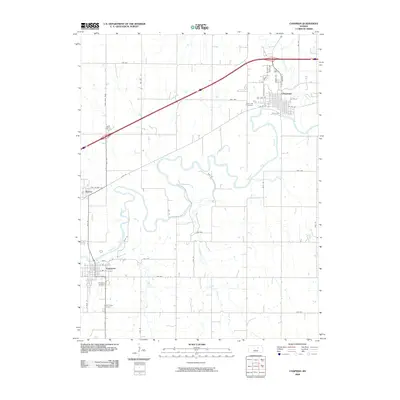
2009 Map of Chapman
USGS Topo · Published 2009About this map
The Smoky Hill River meanders in tight oxbows across the southern half of this quadrangle, defining the landscape between the settlements of Enterprise and Chapman. In the early 21st century, these communities maintained distinct patterns: Enterprise sits along the river's southern bank, while Chapman occupies the northern uplands at the confluence of Chapman Creek. The small community of Detroit is visible to the west, situated where the terrain begins to flatten.
Find a feature on this map
50 named features on this map. Tap any name to fly to it.
Don’t see what you’re looking for? This feature index may not catch every label — zoom into the map to look around manually.
Map Details
Editions of this 2009 Chapman Map
This is the sole edition of this map. No revisions or reprints were ever made.
Other maps of this area

1886 · Junction City
USGS Topo · 1:125,000

1889 · Junction City
USGS Topo · 1:125,000

1889 · Abilene
USGS Topo · 1:125,000

1889 · Parkerville
USGS Topo · 1:125,000

1891 · Clay Center
USGS Topo · 1:125,000

1894 · Junction City
USGS Topo · 1:125,000

1894 · Abilene
USGS Topo · 1:125,000

1894 · Parkerville
USGS Topo · 1:125,000

1947 · Fort Riley
USGS Topo · 1:62,500

1950 · Alida
USGS Topo · 1:24,000