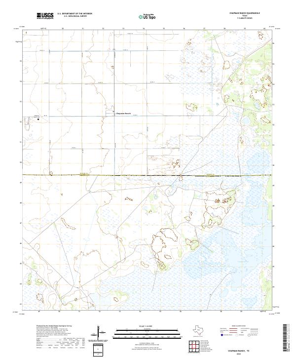
2022 Map of Chapman Ranch
USGS Topo · Published 2022About this map
Chapman Ranch anchors this landscape in southern Nueces County, where the transition from agricultural fields to coastal wetlands is marked by the expansive Laguna Larga. This modern topographical study captures the organized grid of county roads, such as Co RD 8 and Co RD 43, that service the local ranching operations. The Chapman Ranch Cem stands as a focal point for local genealogical interest, located just west of the primary settlement cluster.
Find a feature on this map
15 named features on this map. Tap any name to fly to it.
Don’t see what you’re looking for? This feature index may not catch every label — zoom into the map to look around manually.
Map Details
Editions of this 2022 Chapman Ranch Map
This is the sole edition of this map. No revisions or reprints were ever made.
Other maps of this area

1924 · Petronilla
USGS Topo · 1:62,500

1925 · Oso Creek
USGS Topo · 1:62,500

1928 · Sarita
USGS Topo · 1:125,000

1950 · Corpus Christi
USGS Topo · 1:250,000

1951 · South Bird Island
USGS Topo · 1:24,000

1951 · South Bird Island NW
USGS Topo · 1:24,000

1951 · Oso Creek NW
USGS Topo · 1:24,000

1951 · Oso Creek NE
USGS Topo · 1:24,000

1951 · Riviera Beach NE
USGS Topo · 1:24,000

1951 · Oso Creek
USGS Topo · 1:62,500