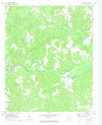
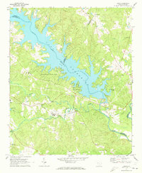
1971 Map of Chappells
USGS Topo · Published 1973About this map
The Saluda River winds through the heart of this Piedmont landscape, serving as the primary boundary between Newberry and Saluda Counties. At the western edge, the settlement of Chappells is situated at a strategic crossing point where the Southern railroad line meets the riverbank, supported by a nearby Gaging Sta. The surrounding terrain is defined by a dense network of tributaries, including Mudlick Creek and Terrapin Creek, which have shaped the local geography into a series of ridges and valleys.
Find a feature on this map
26 named features on this map. Tap any name to fly to it.
Don’t see what you’re looking for? This feature index may not catch every label — zoom into the map to look around manually.
Map Details
Editions of this 1971 Chappells Map
This is the sole edition of this map. No revisions or reprints were ever made.
Other maps of this area

1941 · Spartanburg
USGS Topo · 1:250,000

1953 · Spartanburg
USGS Topo · 1:250,000

1960 · Spartanburg
USGS Topo · 1:250,000

1963 · Spartanburg
USGS Topo · 1:250,000

1964 · Spartanburg
USGS Topo · 1:250,000

1969 · Newberry West
USGS Topo · 1:24,000
1970 · Bush River
USGS Topo · 1:24,000
1970 · Cross Hill
USGS Topo · 1:24,000
1971 · Saluda North
USGS Topo · 1:24,000
1971 · Dyson
USGS Topo · 1:24,000