
1969 Map of Newberry West
USGS Topo · Published 1973About this map
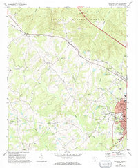
The western outskirts of Newberry and the adjacent community of Helena are defined by the convergence of the Southern and the Columbia Newberry and Laurens railroads. This 1969 survey captures the transition from the concentrated industrial and residential core of the city to the rural landscape of Newberry County. To the northwest, the Sumter National Forest establishes a wooded boundary near Jalapa, while the winding course of the Bush River dictates the placement of long-standing community landmarks like the Bush River Community Center and New Bush River Ch. The map documents a landscape of scattered rural settlements such as Smyrna, Gary, and Longshore, interspersed with numerous small country churches and cemeteries. These features, along with the Newberry Airport and Newberry Country Club, reflect the post-war expansion and the enduring ecclesiastical fabric of the South Carolina Piedmont.
Find a feature on this map
51 named features on this map. Tap any name to fly to it.
Don’t see what you’re looking for? This feature index may not catch every label — zoom into the map to look around manually.
Map Details
Editions of this 1969 Newberry West Map
2 editions found
Other maps of this area

1941 · Spartanburg
USGS Topo · 1:250,000

1953 · Spartanburg
USGS Topo · 1:250,000

1960 · Spartanburg
USGS Topo · 1:250,000

1963 · Spartanburg
USGS Topo · 1:250,000

1964 · Spartanburg
USGS Topo · 1:250,000

1968 · Newberry East
USGS Topo · 1:24,000

1969 · Whitmire South
USGS Topo · 1:24,000

1969 · Newberry NW
USGS Topo · 1:24,000
1970 · Prosperity
USGS Topo · 1:24,000
1970 · Bush River
USGS Topo · 1:24,000