Loading...
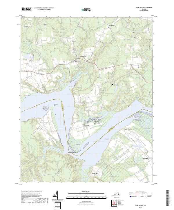
Loading map...2022 Map of Charles City
USGS Topo · Published 2022About this map
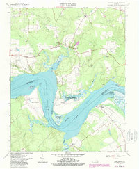
Charles City County Courthouse serves as the focal point of this Tidewater landscape, situated north of a prominent bend in the James River. The map illustrates a region deeply defined by its riparian geometry and long-established estates, including Sherwood Forest and Weyanoke. Along the southern banks in Prince George County, the topography transitions into the marshy lowlands of Kennon Marsh and the historic grounds of Flowerden Hundred.
Find a feature on this map
66 named features on this map. Tap any name to fly to it.
Don’t see what you’re looking for? This feature index may not catch every label — zoom into the map to look around manually.
Map Details
Date Portrayed2022
Date Published2022
PublisherU.S. Geological Survey
Map TypeTopographic
Scale1:24000
Physical Dimensions24 x 29 inches
Editions of this 2022 Charles City Map
This is the sole edition of this map. No revisions or reprints were ever made.
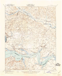
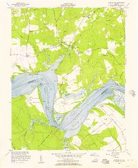
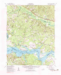
Historical Maps of Sherwood Forest Through Time
6 maps found
Featured Locations
Source Details
SourceU.S. Geological Survey
CopyrightPublic Domain