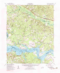
1953 Map of Charles City
USGS Topo · Published 1984About this map
Berkeley and Sherwood Forest anchor the southern reach of this survey, where the James River widens significantly at Threemile Reach. This landscape is defined by the historic riverfront plantations and the transition into the dense swamplands of the interior. North of the river, the Chesapeake and Ohio Railroad corridor connects settlements like Providence Forge and Roxbury, while the central timberlands are dotted with community hubs such as Samaria Indian Sch and Binns Store. The map captures a high concentration of institutional history, from the National Cemetery near Glendale to the colonial legacy of Merchant Hope Ch. South of the river in Prince George County, the landing at Flowerdew Hundred and the ruins of Fort Powhatan illustrate the area's deep strategic and agricultural importance from the earliest days of settlement through the mid-20th century.
Find a feature on this map
138 named features on this map. Tap any name to fly to it.
Don’t see what you’re looking for? This feature index may not catch every label — zoom into the map to look around manually.
Map Details
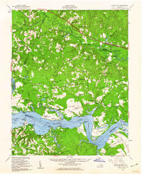
Editions of this 1953 Charles City Map
2 editions found
Other maps of this area

1894 · Bermuda Hundred
USGS Topo · 1:62,500

1894 · Petersburg
USGS Topo · 1:62,500

1894 · Richmond
USGS Topo · 1:62,500

1895 · Richmond
USGS Topo · 1:62,500

1917 · Toano
USGS Topo · 1:62,500

1918 · Charles City
USGS Topo · 1:62,500

1918 · Toano
USGS Topo · 1:62,500

1919 · Surry
USGS Topo · 1:62,500

1919 · Disputanta
USGS Topo · 1:62,500

1919 · New Kent
USGS Topo · 1:62,500