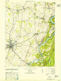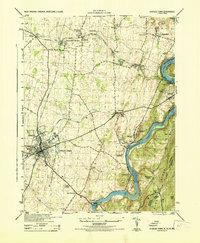
1944 Map of Charles Town
USGS Topo · Published 1944About this map
Charles Town and Ranson serve as the industrial and residential anchors of this mid-century survey, where the Baltimore and Ohio and Norfolk and Western railroads intersect. The landscape is deeply tied to the winding Shenandoah River and Potomac River, with industrial sites like Limestone Quarry and the Power Plant near Millville highlighting the era's reliance on river-bound resources. The map captures a detailed transition from the urban grid of the county seat to the outlying agricultural and mining hamlets of Bakerton and Halltown.
Find a feature on this map
51 named features on this map. Tap any name to fly to it.
Don’t see what you’re looking for? This feature index may not catch every label — zoom into the map to look around manually.
Map Details
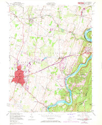
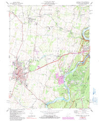
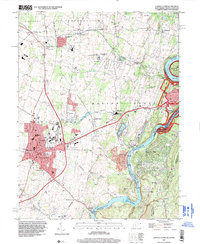
Editions of this 1944 Charles Town Map
This is the sole edition of this map. No revisions or reprints were ever made.
Historical Maps of Charles Town Through Time
6 maps found