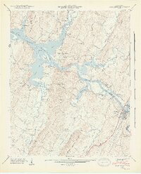
1943 Map of Charleston
USGS Topo · Published 1946About this map
The Hiwassee River serves as the focal point for this mid-century landscape, dividing the settlements of Charleston in Bradley County and Calhoun in McMinn County. The 1942 field examination captures the area shortly after the filling of the Chickamauga Reservoir, showing how the backwaters of the Tennessee Valley Authority project transformed former creek beds like Rogers Creek and Candies Creek into significant embayments. This transition from riverine to reservoir landscape is evident along Ledford Island and the inundated mouths of numerous branches.
Find a feature on this map
49 named features on this map. Tap any name to fly to it.
Don’t see what you’re looking for? This feature index may not catch every label — zoom into the map to look around manually.
Map Details
Editions of this 1943 Charleston Map
2 editions found
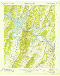
Other maps of this area

1886 · Cleveland
USGS Topo · 1:125,000

1892 · Cleveland
USGS Topo · 1:125,000

1895 · Cleveland
USGS Topo · 1:125,000

1901 · Cleveland
USGS Topo · 1:125,000

1935 · East Cleveland
USGS Topo · 1:24,000

1935 · Calhoun
USGS Topo · 1:24,000

1935 · Benton
USGS Topo · 1:24,000

1935 · Goodfield
USGS Topo · 1:24,000

1935 · Charleston
USGS Topo · 1:24,000
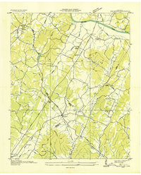
1935 · Birchwood
USGS Topo · 1:24,000