Loading...
Loading map...2024 Map of Charleston
USGS Topo · Published 2024About this map
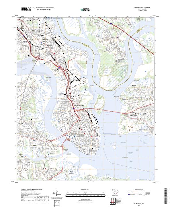
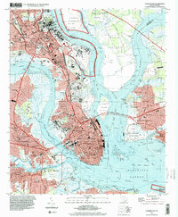
Charleston and North Charleston dominate this detailed survey of the Lowcountry, capturing the intricate relationship between the peninsula and its surrounding waterways. The urban core is flanked by the Ashley River and Cooper River, with the historic street grid leading down to S Battery and Oyster Point. The map provides significant genealogical value through its many burial grounds, including Magnolia Cem, Saint Lawrence Cem, and the Hebrew Cem.
Find a feature on this map
105 named features on this map. Tap any name to fly to it.
Don’t see what you’re looking for? This feature index may not catch every label — zoom into the map to look around manually.
Map Details
Date Portrayed2024
Date Published2024
PublisherU.S. Geological Survey
Map TypeTopographic
Scale1:24000
Physical Dimensions24 x 29 inches
Editions of this 2024 Charleston Map
This is the sole edition of this map. No revisions or reprints were ever made.
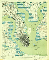
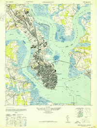
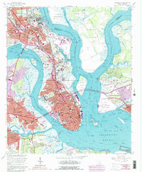
Historical Maps of Union Heights Through Time
5 maps found
Featured Locations
- North Charleston, SC
- Charleston, SC
- Ashley Junction, North Charleston
- Mount Pleasant, SC
- Murray Landing, SC
Source Details
SourceU.S. Geological Survey
CopyrightPublic Domain