
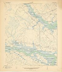
1919 Map of Johns Island
USGS Topo · Published 1919About this map
The Ashley River and Stono River define this coastal landscape just after the First World War, where the historic estates and strategic defenses of the South Carolina Lowcountry remain visible. Prominent landmarks such as Drayton Hall, Ashley Hall, and the St Andrews Church anchor the social and religious life of the district, while ruins and fortifications including Fort Bull and several sites marked Old Fort suggest a layered military history along the waterways.
Find a feature on this map
53 named features on this map. Tap any name to fly to it.
Don’t see what you’re looking for? This feature index may not catch every label — zoom into the map to look around manually.
Map Details
Editions of this 1919 Johns Island Map
2 editions found
Other maps of this area

1919 · Ladson
USGS Topo · 1:21,120

1919 · Wadmelaw Island
USGS Topo · 1:62,500

1919 · Melgrove
USGS Topo · 1:21,120

1919 · Charleston
USGS Topo · 1:21,120

1919 · James Island
USGS Topo · 1:21,120

1919 · Legareville
USGS Topo · 1:21,120

1920 · Ravenels
USGS Topo · 1:62,500

1940 · Melgrove
USGS Topo · 1:24,000

1943 · Legareville
USGS Topo · 1:24,000

1943 · James Island
USGS Topo · 1:24,000