
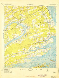
1943 Map of Legareville
USGS Topo · Published 1943About this map
Johns Island and Wadmalaw Island dominate this lowcountry coastal survey, revealing a landscape defined by expansive tidal waterways and localized agricultural settlements. At the center of the map, the village of Legareville sits at the confluence of Abbapoola Creek and the Stono River, supported by the Legareville School. Further inland, the map captures a network of rural hubs including Miller Hill and several church-centered communities like Johns Island Church and Mt Zion Church.
Find a feature on this map
27 named features on this map. Tap any name to fly to it.
Don’t see what you’re looking for? This feature index may not catch every label — zoom into the map to look around manually.
Map Details
Editions of this 1943 Legareville Map
2 editions found
Other maps of this area

1918 · Kiawah Island
USGS Topo · 1:21,120

1919 · Johns Island
USGS Topo · 1:21,120

1919 · Wadmelaw Island
USGS Topo · 1:62,500

1919 · Charleston
USGS Topo · 1:21,120

1919 · James Island
USGS Topo · 1:21,120

1919 · Legareville
USGS Topo · 1:21,120

1920 · Ravenels
USGS Topo · 1:62,500

1943 · James Island
USGS Topo · 1:24,000

1943 · Kiawah Island
USGS Topo · 1:24,000

1944 · Ravenels
USGS Topo · 1:62,500