
1943 Map of Kiawah Island
USGS Topo · Published 1943About this map
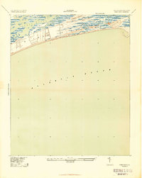
Kiawah Island is depicted here during the early 1940s, a period when the South Carolina coastline remained largely undeveloped and focused on maritime and agricultural geography. Produced by the War Department and Corps of Engineers, U.S. Army, this survey details the intricate network of tidal marshlands and barrier beach topography. The southern edge of Johns Island is visible across the winding Kiawah River, illustrating the separation between the mainland and the seaward islands. Distinctive landforms such as Cinder Point and Eagle Point reach into the marshy interior, while Sandy Point defines the eastern tip where the river meets the Atlantic Ocean. The map's layout emphasizes the island's natural coastal progression and the shifting sands of the Atlantic shoreline prior to mid-century development.
Find a feature on this map
7 named features on this map. Tap any name to fly to it.
Don’t see what you’re looking for? This feature index may not catch every label — zoom into the map to look around manually.
Map Details
Editions of this 1943 Kiawah Island Map
2 editions found
Other maps of this area

1918 · Kiawah Island
USGS Topo · 1:21,120

1919 · Wadmelaw Island
USGS Topo · 1:62,500

1919 · James Island
USGS Topo · 1:21,120

1919 · Legareville
USGS Topo · 1:21,120

1943 · Legareville
USGS Topo · 1:24,000

1943 · James Island
USGS Topo · 1:24,000

1944 · Wadmelaw Island
USGS Topo · 1:62,500

1947 · Savannah
USGS Topo · 1:250,000

1948 · James Island
USGS Topo · 1:250,000

1948 · Savannah
USGS Topo · 1:250,000