1918 Map of Kiawah Island
USGS Topo · Published 1918About this map
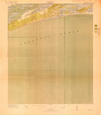
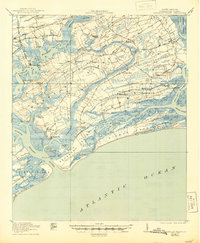
Kiawah Island is depicted here as a coastal wilderness just as the War Department and U.S. Geological Survey collaborated to map this section of the South Carolina coast during the First World War. The landscape is primarily characterized by woods and brush, with Avenue Road serving as one of the few formal terrestrial markers on the island. The survey emphasizes the intricate shoreline where the Kiawah River separates the main island from Johns Island to the north.
Find a feature on this map
9 named features on this map. Tap any name to fly to it.
Don’t see what you’re looking for? This feature index may not catch every label — zoom into the map to look around manually.
Map Details
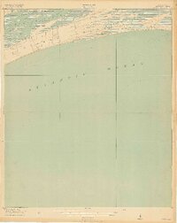
Editions of this 1918 Kiawah Island Map
2 editions found
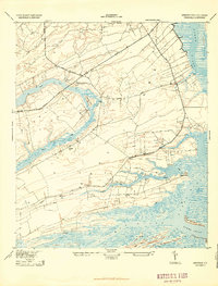
Other maps of this area

1919 · Wadmelaw Island
USGS Topo · 1:62,500

1919 · James Island
USGS Topo · 1:21,120

1919 · Legareville
USGS Topo · 1:21,120
1943 · Legareville
USGS Topo · 1:24,000

1943 · James Island
USGS Topo · 1:24,000
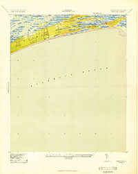
1943 · Kiawah Island
USGS Topo · 1:24,000
1944 · Wadmelaw Island
USGS Topo · 1:62,500

1947 · Savannah
USGS Topo · 1:250,000

1948 · James Island
USGS Topo · 1:250,000

1948 · Savannah
USGS Topo · 1:250,000