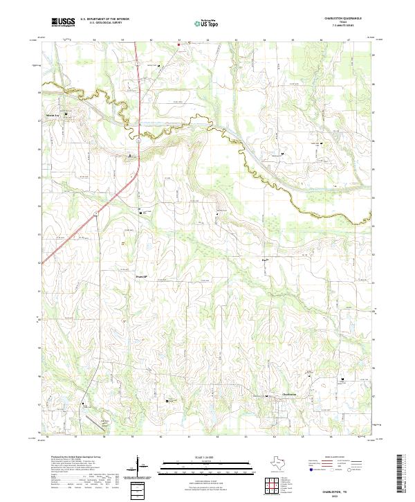
2022 Map of Charleston
USGS Topo · Published 2022About this map
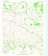
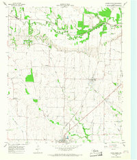
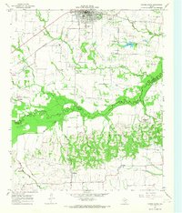
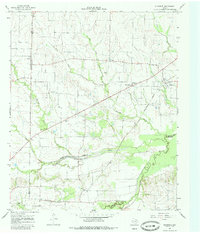
The North Sulphur River creates a meandering natural border between Lamar and Delta counties, defining a landscape of creek bottoms and rural crossroads. This area of northeast Texas remains characterized by its dense network of family and community cemeteries, which serve as silent markers of nineteenth-century settlement patterns. Localities like Charleston and Pacio are situated among a web of seasonal waterways including Lake Cr and Post Oak Cr. The presence of small, dispersed communities such as Prattville and Mount Joy suggests a history of localized farming centers that once served the surrounding cotton and cattle country. While the terrain is relatively level, the intricate drainage of numerous branches like Evans Br and McGuyer Br has historically dictated the placement of roads and homesteads, creating the distinct rural patchwork visible in this contemporary survey.
Find a feature on this map
84 named features on this map. Tap any name to fly to it.
Don’t see what you’re looking for? This feature index may not catch every label — zoom into the map to look around manually.
Map Details
Editions of this 2022 Charleston Map
This is the sole edition of this map. No revisions or reprints were ever made.
Historical Maps of Mount Joy Through Time
8 maps found