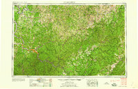
1958 Map of Charleston
USGS Topo · Published 1958About this map
The Kanawha River serves as the industrial and logistical spine of this region during the late 1950s, anchoring the capital at Charleston and its surrounding manufacturing hubs like South Charleston, St Albans, and Nitro. This era represents the height of the river-and-rail economy, where the Chesapeake and Ohio and Baltimore and Ohio railroads parallel the water systems to move timber and coal from the interior. To the east, the terrain rises sharply into the Allegheny Mountains and the dense timberlands of the Monongahela National Forest. Within these highlands, smaller settlements like Richwood and Webster Springs are interconnected by winding routes such as Us 119 and W Va 16. The map captures a landscape defined by its knobs and ridges, including Rich Mountain and Bird Knob, illustrating the difficult geography that shaped West Virginia's early development and transit corridors.
Find a feature on this map
92 named features on this map. Tap any name to fly to it.
Don’t see what you’re looking for? This feature index may not catch every label — zoom into the map to look around manually.
Map Details
Editions of this 1958 Charleston Map
This is the sole edition of this map. No revisions or reprints were ever made.
Other maps of this area

1886 · St. George
USGS Topo · 1:125,000

1887 · Warfield
USGS Topo · 1:125,000

1887 · Hinton
USGS Topo · 1:125,000

1887 · Lewisburg
USGS Topo · 1:125,000

1889 · Nicholas
USGS Topo · 1:125,000

1889 · Beverly
USGS Topo · 1:125,000

1891 · Lewisburg
USGS Topo · 1:125,000

1891 · Nicholas
USGS Topo · 1:125,000

1891 · Huntersville
USGS Topo · 1:125,000

1891 · Oceana
USGS Topo · 1:125,000