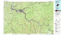
1984 Map of Charleston
USGS Topo · Published 1987About this map
The Kanawha River serves as the industrial and civic spine of this West Virginia landscape, winding past the State Capitol and through a dense corridor of river towns. The 1980s infrastructure is well-defined, showing the intersection of heavy rail lines like the Chesapeake & Ohio RR and Conrail with the interstate expansion of I-64 and I-79. Beyond the urban centers of Charleston, South Charleston, and Saint Albans, the terrain is marked by extensive Strip Mines and the deep relief of the New River Gorge. Educational and transit hubs are prominent, from West Virginia State College in Institute to Yeager Airport perched above the valley. This survey captures the region at a peak of its extraction-based economy and transportation development, balanced by large protected areas such as Kanawha State Forest and Babcock State Park.
Find a feature on this map
213 named features on this map. Tap any name to fly to it.
Don’t see what you’re looking for? This feature index may not catch every label — zoom into the map to look around manually.
Map Details
Editions of this 1984 Charleston Map
2 editions found
Other maps of this area

1887 · Warfield
USGS Topo · 1:125,000

1887 · Hinton
USGS Topo · 1:125,000

1889 · Nicholas
USGS Topo · 1:125,000

1891 · Nicholas
USGS Topo · 1:125,000

1891 · Oceana
USGS Topo · 1:125,000

1891 · Raleigh
USGS Topo · 1:125,000

1891 · Warfield
USGS Topo · 1:125,000

1892 · Hinton
USGS Topo · 1:125,000

1892 · Huntington
USGS Topo · 1:125,000

1893 · Oceana
USGS Topo · 1:125,000