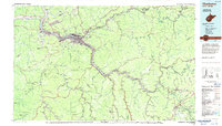
1984 Map of Charleston
USGS Topo · Published 1984About this map
The Kanawha River serves as the industrial and transportation spine of this 1980s landscape, connecting the capital at Charleston with a string of riverside towns including Saint Albans, Nitro, and Dunbar. Heavy infrastructure is prominent, from the Kanawha Airport on the heights to the London Lock and Dam and Marmet Lock and Dam regulating the river's flow. Educational landmarks like West Virginia State College and the West Virginia Institute of Technology anchor their respective communities, while the complex rail network of the Chesapeake & Ohio and Baltimore & Ohio railroads highlights the region's enduring role in coal and freight transport.
Find a feature on this map
402 named features on this map. Tap any name to fly to it.
Don’t see what you’re looking for? This feature index may not catch every label — zoom into the map to look around manually.
Map Details
Editions of this 1984 Charleston Map
2 editions found
Other maps of this area

1887 · Warfield
USGS Topo · 1:125,000

1887 · Hinton
USGS Topo · 1:125,000

1889 · Nicholas
USGS Topo · 1:125,000

1891 · Nicholas
USGS Topo · 1:125,000

1891 · Oceana
USGS Topo · 1:125,000

1891 · Raleigh
USGS Topo · 1:125,000

1891 · Warfield
USGS Topo · 1:125,000

1892 · Hinton
USGS Topo · 1:125,000

1892 · Huntington
USGS Topo · 1:125,000

1893 · Oceana
USGS Topo · 1:125,000