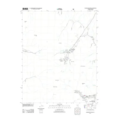
2012 Map of Charleston Peak
USGS Topo · Published 2012About this map
Charleston Peak and the surrounding high-altitude terrain in Clark County define this 2012 survey, which documents a landscape organized around seasonal recreation and alpine residential pockets. The Lee Canyon Summer Home Area and Kyle Canyon Summer Home Area serve as primary anchors for local development, supported by a network of specialized facilities like the Lady of the Snows Chapel and Mount Charleston Lodge. The map details an extensive system of forest access, including Forest Rd 71 and Wheeler Pass Rd, which connect various remote water sources such as McWilliams Spring and Mud Springs.
Find a feature on this map
61 named features on this map. Tap any name to fly to it.
Don’t see what you’re looking for? This feature index may not catch every label — zoom into the map to look around manually.
Map Details
Editions of this 2012 Charleston Peak Map
This is the sole edition of this map. No revisions or reprints were ever made.
Other maps of this area

1907 · Las Vegas
USGS Topo · 1:250,000

1908 · Las Vegas
USGS Topo · 1:250,000

1954 · Las Vegas
USGS Topo · 1:250,000

1957 · Las Vegas
USGS Topo · 1:250,000

1957 · Mt. Stirling
USGS Topo · 1:62,500

1957 · Charleston Peak
USGS Topo · 1:62,500

1957 · Mountain Springs
USGS Topo · 1:62,500
1958 · Pahrump
USGS Topo · 1:62,500

1959 · Las Vegas
USGS Topo · 1:250,000

1962 · Las Vegas
USGS Topo · 1:250,000