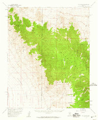
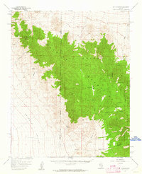
1957 Map of Mt. Stirling
USGS Topo · Published 1959About this map
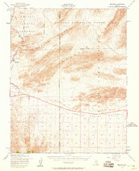
Mt Stirling serves as a prominent landmark within the Spring Mountains, a landscape defined by sharp elevation changes and high-altitude water sources. This 1950s survey captures a transition between the Pahrump Valley to the west and the expansive Desert Game Range and Toiyabe National Forest lands to the east. Isolated infrastructure such as the Charcoal Kiln and various Prospects and a Shaft point to a history of resource extraction in these mountains.
Find a feature on this map
27 named features on this map. Tap any name to fly to it.
Don’t see what you’re looking for? This feature index may not catch every label — zoom into the map to look around manually.
Map Details
Editions of this 1957 Mt. Stirling Map
2 editions found
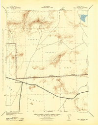
Other maps of this area

1907 · Las Vegas
USGS Topo · 1:250,000

1908 · Furnace Creek
USGS Topo · 1:250,000

1908 · Las Vegas
USGS Topo · 1:250,000

1910 · Furnace Creek
USGS Topo · 1:250,000

1942 · Indian Spring
USGS Topo · 1:125,000
1942 · Skull Mountain
USGS Topo · 1:125,000

1948 · Death Valley
USGS Topo · 1:250,000
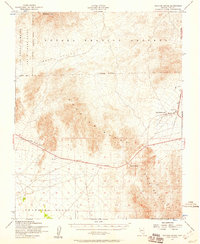
1952 · Specter Range
USGS Topo · 1:62,500
1952 · Mercury
USGS Topo · 1:62,500

1954 · Las Vegas
USGS Topo · 1:250,000