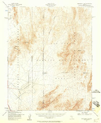
1952 Map of Mercury
USGS Topo · Published 1958About this map
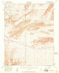
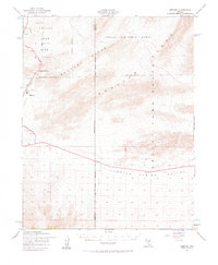
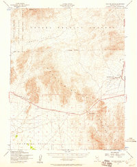
The settlement of Mercury stands at the heart of this Cold War-era landscape, serving as the administrative and residential hub for the Nevada Proving Grounds. The map illustrates the specialized infrastructure required for nuclear testing and military operations, including a vital Aqueduct, a Pumping Station, and the primary Mercury Highway. To the east, the vast Las Vegas Bombing and Gunnery Range extends across a series of prominent mountain chains, including the Spotted Range and the Desert Range. The topography is defined by significant barriers like Mercury Ridge and strategic points such as Checkpoint Pass. In the southern portion of the sheet, the expansive Indian Springs Valley provides a stark contrast to the high ridges, revealing the isolated and secure nature of this federal reservation in the early 1950s.
Find a feature on this map
13 named features on this map. Tap any name to fly to it.
Don’t see what you’re looking for? This feature index may not catch every label — zoom into the map to look around manually.
Map Details
Editions of this 1952 Mercury Map
2 editions found
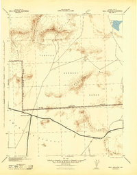
Other maps of this area

1907 · Las Vegas
USGS Topo · 1:250,000

1908 · Furnace Creek
USGS Topo · 1:250,000

1908 · Las Vegas
USGS Topo · 1:250,000

1910 · Furnace Creek
USGS Topo · 1:250,000

1942 · Indian Spring
USGS Topo · 1:125,000
1942 · Skull Mountain
USGS Topo · 1:125,000

1948 · Death Valley
USGS Topo · 1:250,000
1952 · Specter Range
USGS Topo · 1:62,500
1952 · Frenchman Lake
USGS Topo · 1:62,500
1952 · Cane Spring
USGS Topo · 1:62,500