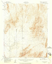
1952 Map of Frenchman Lake
USGS Topo · Published 1958About this map
The Nevada Proving Grounds and an expansive Bombing and Gunnery Range dominate this mid-century survey of the high desert. This area, spanning the borders of Nye, Lincoln, and Clark counties, was at the center of Cold War military operations during the early 1950s. The landscape is defined by vast playas, including Yucca Flat and Frenchman Flat, which are surrounded by prominent topographic features such as the Las Vegas Range, the Ranger Mountains, and the Spotted Range. The Mercury Highway provides the primary transit artery through this restricted zone, passing near an Aqueduct and the dry bed of Frenchman Lake. Prominent summits like French Peak and Massachusetts Mtn serve as landmarks within this high-security territory, where geological survey work intersected with atomic-era strategic defense.
Find a feature on this map
22 named features on this map. Tap any name to fly to it.
Don’t see what you’re looking for? This feature index may not catch every label — zoom into the map to look around manually.
Map Details
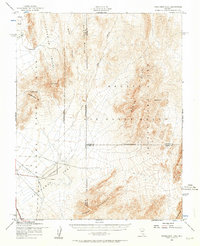
Editions of this 1952 Frenchman Lake Map
3 editions found
Other maps of this area

1907 · Las Vegas
USGS Topo · 1:250,000

1908 · Kawich
USGS Topo · 1:250,000

1908 · Furnace Creek
USGS Topo · 1:250,000

1908 · Las Vegas
USGS Topo · 1:250,000

1910 · Furnace Creek
USGS Topo · 1:250,000

1942 · Emigrant Valley
USGS Topo · 1:125,000

1942 · Indian Spring
USGS Topo · 1:125,000

1942 · Wheelbarrow Peak
USGS Topo · 1:125,000

1942 · Skull Mountain
USGS Topo · 1:125,000

1948 · Death Valley
USGS Topo · 1:250,000