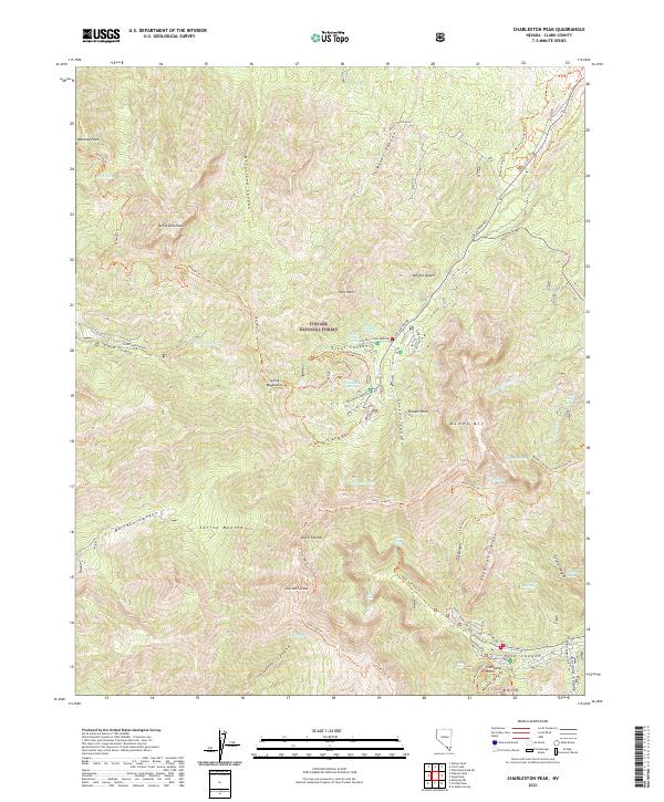
2021 Map of Charleston Peak
USGS Topo · Published 2021About this map
Charleston Peak and the high elevations of the Spring Mountains dominate this landscape within the Toiyabe National Forest. The area is defined by a network of steep canyons and ridges, including Kyle Canyon, Lee Canyon, and Wallace Canyon, which serve as primary corridors for both road access and hiking trails. The terrain transitions from the low Mojave Desert to the alpine heights of Mummy Mtn, where numerous seasonal water sources and springs, such as McWilliams Spring and Peak Spring, supported early recreational development. This 2021 survey details the established infrastructure for alpine recreation, featuring labels for the Old Mill Picnic Area Rd and Dolomite Campground Rd. The southeastern portion of the map highlights localized settlement patterns near Cathedral Rock, with the presence of Kyle Summer Homes Rd indicating a established mountain retreat community.
Find a feature on this map
66 named features on this map. Tap any name to fly to it.
Don’t see what you’re looking for? This feature index may not catch every label — zoom into the map to look around manually.
Map Details
Editions of this 2021 Charleston Peak Map
This is the sole edition of this map. No revisions or reprints were ever made.
Other maps of this area

1907 · Las Vegas
USGS Topo · 1:250,000

1908 · Las Vegas
USGS Topo · 1:250,000

1954 · Las Vegas
USGS Topo · 1:250,000

1957 · Las Vegas
USGS Topo · 1:250,000

1957 · Mt. Stirling
USGS Topo · 1:62,500

1957 · Charleston Peak
USGS Topo · 1:62,500

1957 · Mountain Springs
USGS Topo · 1:62,500
1958 · Pahrump
USGS Topo · 1:62,500

1959 · Las Vegas
USGS Topo · 1:250,000

1962 · Las Vegas
USGS Topo · 1:250,000