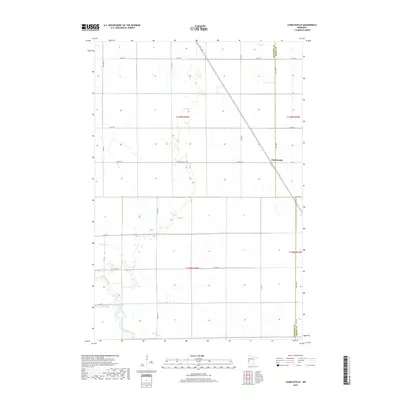
2019 Map of Charlesville
USGS Topo · Published 2019About this map
The settlement of Charlesville anchors the eastern edge of this agricultural landscape along the boundary between Traverse Co and Grant Co. The terrain is defined by a complex drainage system, where the Mustinka River winds through the southern portion of the township. Local waterways, including Fivemile Cr, Twelvemile Creek, and the Old Channel, create a network of natural boundaries across the flat prairie lands. The map reveals a strictly regulated grid of section lines and rural roads, such as Co Hwy 13 and Co Rd 95, which facilitate the region's farming economy. The presence of Twelvemile Cr in the southwest corner highlights the intricate hydrography that has shaped land use and field patterns in this part of western Minnesota.
Find a feature on this map
28 named features on this map. Tap any name to fly to it.
Don’t see what you’re looking for? This feature index may not catch every label — zoom into the map to look around manually.
Map Details
Editions of this 2019 Charlesville Map
This is the sole edition of this map. No revisions or reprints were ever made.
Other maps of this area

1910 · Wendell
USGS Topo · 1:62,500

1911 · Herman
USGS Topo · 1:62,500

1913 · Wendell
USGS Topo · 1:62,500

1951 · Wheaton
USGS Topo · 1:62,500

1951 · Campbell
USGS Topo · 1:62,500

1953 · Milbank
USGS Topo · 1:250,000

1953 · Fargo
USGS Topo · 1:250,000

1956 · Fargo
USGS Topo · 1:250,000

1958 · Milbank
USGS Topo · 1:250,000

1973 · Herman NW
USGS Topo · 1:24,000