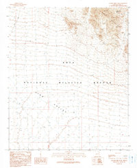
1990 Map of Charlie Died Tank
USGS Topo · Published 1990About this map
Kofa National Wildlife Refuge dominates this desert landscape, preserving a vast expanse of the Sonoran Desert as it appeared in the late 20th century. The terrain is sharply divided between the jagged peaks of the Kofa Mountains in the northeast and the wide, sloping basin of King Valley that sweeps across the southwest. Water sources in this arid environment are critical and sparse, marked by features such as Charlie Died Tank, which serves as a vital point for wildlife and a landmark for those navigating the backcountry. A solitary Trail is the primary evidence of human passage through the central valley, underscoring the remote and protected nature of this wilderness area during the 1990 provisional mapping.
Find a feature on this map
5 named features on this map. Tap any name to fly to it.
Don’t see what you’re looking for? This feature index may not catch every label — zoom into the map to look around manually.
Map Details
Editions of this 1990 Charlie Died Tank Map
This is the sole edition of this map. No revisions or reprints were ever made.
Other maps of this area

1942 · Blythe
USGS Topo · 1:250,000

1942 · Vicksburg
USGS Topo · 1:250,000

1954 · Salton Sea
USGS Topo · 1:250,000

1954 · Phoenix
USGS Topo · 1:250,000

1955 · Salton Sea
USGS Topo · 1:250,000

1957 · Phoenix
USGS Topo · 1:250,000

1958 · Phoenix
USGS Topo · 1:250,000

1959 · Salton Sea
USGS Topo · 1:250,000

1960 · Phoenix
USGS Topo · 1:250,000

1962 · Kofa Butte
USGS Topo · 1:62,500