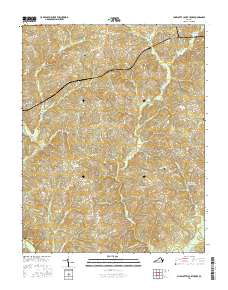
2016 Map of Charlotte Court House
USGS Topo · Published 2016About this map
Charlotte Court House serves as the focal point of this Southside Virginia landscape, situated where the ridge-top roads of the Piedmont converge. The surrounding territory is defined by a dense network of creek drainages including Wards Fork Cr and Cub Cr, which feed south toward the Roanoke River. For genealogists and local historians, the sheet preserves the locations of numerous family and community sites, such as Evergreen Cem, Martin Cem, and Gillispie Cem. Small rural settlements like Womacks, Phenix, and Cullen are mapped along the winding routes of Germantown Rd and Virginian Rd. The presence of the Layne Farm Airstrip and reservoirs like Roanoke Cr Site 35-A Lake reflect more recent land-use patterns in this traditionally agricultural region, where the terrain remains deeply carved by the persistent flow of Terrys Cr and Sandy Cr.
Find a feature on this map
81 named features on this map. Tap any name to fly to it.
Don’t see what you’re looking for? This feature index may not catch every label — zoom into the map to look around manually.
Map Details
Editions of this 2016 Charlotte Court House Map
This is the sole edition of this map. No revisions or reprints were ever made.
Other maps of this area

1892 · Appomattox
USGS Topo · 1:125,000

1947 · Roanoke
USGS Topo · 1:250,000

1953 · Greensboro
USGS Topo · 1:250,000

1954 · Greensboro
USGS Topo · 1:250,000

1954 · Clover
USGS Topo · 1:62,500

1954 · Halifax
USGS Topo · 1:62,500

1956 · Brookneal
USGS Topo · 1:62,500

1956 · Charlotte Court House
USGS Topo · 1:62,500

1959 · Roanoke
USGS Topo · 1:250,000

1962 · Greensboro
USGS Topo · 1:250,000