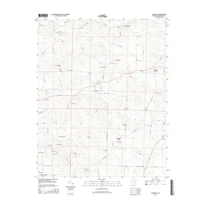
2014 Map of Charlotte
USGS Topo · Published 2014About this map
Sulphur Rock anchors the southwestern corner of this Independence County landscape, where the terrain begins to ripple into the hollows of the Ozark foothills. The area is defined by a dense network of small rural settlements including Charlotte, Walnut Grove, and Pleasant Hill, connected by a web of winding roads like White Dr and Antioch Rd. This 2014 survey reveals a territory where local history is preserved in numerous family and community burial grounds, such as Rawlings Cem, Holcombe Cem, and the uniquely named Convenience Cem. Water drainage is central to the land's character, with Dota Cr and its various branches like Dry Fork Dota Cr carving through the hills. A notable modern landmark is Henley Aerodrome, situated just north of Charlotte, serving as a distinct aviation point amidst the predominantly agricultural and wooded countryside near Pascoe J Stafford Lake.
Find a feature on this map
94 named features on this map. Tap any name to fly to it.
Don’t see what you’re looking for? This feature index may not catch every label — zoom into the map to look around manually.
Map Details
Editions of this 2014 Charlotte Map
This is the sole edition of this map. No revisions or reprints were ever made.
Other maps of this area

1890 · Batesville
USGS Topo · 1:125,000

1891 · Batesville
USGS Topo · 1:125,000

1932 · Strawberry
USGS Topo · 1:62,500

1935 · Strawberry
USGS Topo · 1:62,500

1935 · Newport
USGS Topo · 1:62,500

1941 · Strawberry
USGS Topo · 1:62,500

1942 · Salado
USGS Topo · 1:31,680

1943 · Cave City
USGS Topo · 1:31,680

1943 · Sulphur Rock
USGS Topo · 1:31,680

1953 · Memphis
USGS Topo · 1:250,000