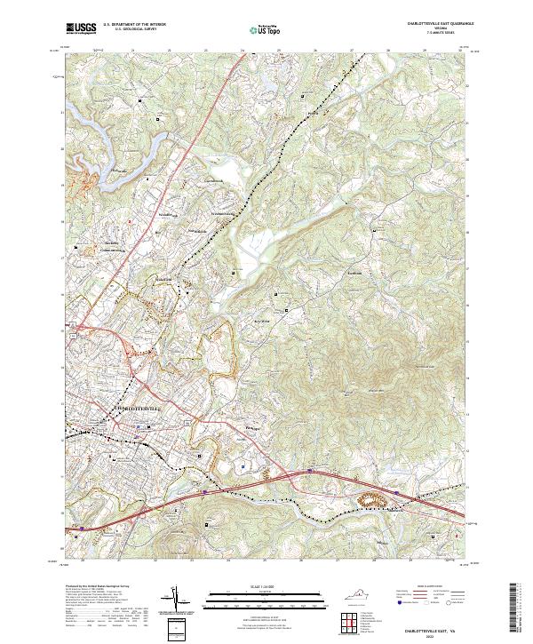
2022 Map of Charlottesville East
USGS Topo · Published 2022About this map
Charlottesville and its surrounding Albemarle County landscape are defined by the convergence of the South Fork Rivanna River and North Fork Rivanna River. This survey captures the region's deep historical layers, from the civic center at the Albemarle County Courthouse to the significant commemorative sites of the Jefferson Tomb and Monticello Graveyard. The topography is shaped by the Southwest Mountains, including prominent peaks like Trevillian Mtn and Wolfpit Mtn, which overlook the growing corridors of Pantops and Shadwell. Transport networks are anchored by Csx Transportation rail lines and the busy Seminole Trl. The map preserves the locations of numerous family and community burial grounds, such as Garrison Cem, Coles Cem, and Chapman Grove Cem, which provide essential touchpoints for genealogical research in this part of Virginia.
Find a feature on this map
69 named features on this map. Tap any name to fly to it.
Don’t see what you’re looking for? This feature index may not catch every label — zoom into the map to look around manually.
Map Details
Editions of this 2022 Charlottesville East Map
This is the sole edition of this map. No revisions or reprints were ever made.
Other maps of this area

1891 · Palmyra
USGS Topo · 1:125,000

1892 · Buckingham
USGS Topo · 1:125,000

1892 · Gordonsville
USGS Topo · 1:125,000

1892 · Harrisonburg
USGS Topo · 1:125,000

1895 · Palmyra
USGS Topo · 1:125,000

1897 · Palmyra
USGS Topo · 1:125,000

1929 · Covesville
USGS Topo · 1:62,500

1931 · University
USGS Topo · 1:62,500

1935 · Charlottesville
USGS Topo · 1:62,500

1935 · Charlottesville And Vicinity
USGS Topo · 1:31,680