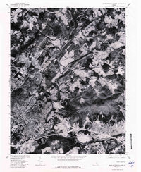
1977 Map of Charlottesville East
USGS Topo · Published 1982About this map
Charlottesville serves as the central hub of this 1977 orthophoto, where the urban grid of the city meets the winding paths of the Virginia piedmont. The landscape is defined by the confluence of the North Fork Rivanna River and the South Fork Rivanna River, which snake through the terrain north of the city center. To the east, the historic settlement of Shadwell sits near the base of Wolfpit Mountain, marking a transition from the developing residential outskirts to more wooded and agricultural lands. This aerial perspective, produced in cooperation with the Soil Conservation Service, captures the mid-seventies footprint of the region, showing the density of growth along Moores Creek and the rural character surrounding Eastham. The imagery provides a clear view of land use patterns, from the organized streets of the university town to the expansive forest cover and river bottomlands that characterize this portion of Albemarle County.
Find a feature on this map
7 named features on this map. Tap any name to fly to it.
Don’t see what you’re looking for? This feature index may not catch every label — zoom into the map to look around manually.
Map Details
Editions of this 1977 Charlottesville East Map
This is the sole edition of this map. No revisions or reprints were ever made.
Other maps of this area

1891 · Palmyra
USGS Topo · 1:125,000

1892 · Buckingham
USGS Topo · 1:125,000

1892 · Gordonsville
USGS Topo · 1:125,000

1892 · Harrisonburg
USGS Topo · 1:125,000

1895 · Palmyra
USGS Topo · 1:125,000

1897 · Palmyra
USGS Topo · 1:125,000

1929 · Covesville
USGS Topo · 1:62,500

1931 · University
USGS Topo · 1:62,500

1935 · Charlottesville
USGS Topo · 1:62,500

1935 · Charlottesville And Vicinity
USGS Topo · 1:31,680