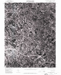
1972 Map of Charlottesville West
USGS Topo · Published 1974About this map
The southern Piedmont landscape of central Virginia is revealed in this 1972 aerial study, where the distinctive landforms of the Ragge Mountains dominate the southwestern terrain. This orthophotomap, produced through the cooperation of James L. Calver and the Commonwealth of Virginia Division of Mineral Resources, provides a precise visual record of the region's mid-century development. The expanding transportation network is anchored by Route 250, which cuts an east-west path across the center of the sheet. The imagery captures the transition between the rolling wooded uplands and the increasingly organized agricultural and suburban plots surrounding the urban fringe. By using corrected aerial photography rather than traditional topographic lines, this survey offers researchers a literal view of tree cover, field boundaries, and road alignments exactly as they existed during the early 1970s.
Find a feature on this map
2 named features on this map. Tap any name to fly to it.
Don’t see what you’re looking for? This feature index may not catch every label — zoom into the map to look around manually.
Map Details
Editions of this 1972 Charlottesville West Map
This is the sole edition of this map. No revisions or reprints were ever made.
Other maps of this area

1891 · Palmyra
USGS Topo · 1:125,000

1892 · Buckingham
USGS Topo · 1:125,000

1892 · Gordonsville
USGS Topo · 1:125,000

1892 · Harrisonburg
USGS Topo · 1:125,000

1895 · Palmyra
USGS Topo · 1:125,000

1897 · Palmyra
USGS Topo · 1:125,000

1929 · Covesville
USGS Topo · 1:62,500

1931 · University
USGS Topo · 1:62,500

1935 · Charlottesville
USGS Topo · 1:62,500

1935 · Charlottesville And Vicinity
USGS Topo · 1:31,680