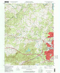
1997 Map of Charlottesville West
USGS Topo · Published 1999About this map
The Univ Of Virginia dominates the eastern edge of this late 20th-century landscape, showcasing the university’s institutional footprint with landmarks like Scott Stadium, McCormick Observatory, and Lambeth Field. Moving west from the city of Charlottesville, the terrain transitions into a series of residential developments and academic institutions, including Ednam Forest, St Anne's Sch, and the Institute of Textile Technology. The map documents a sophisticated suburban expansion anchored by the Farmington Country Club and neighborhoods like West Leigh and Bellair.
Find a feature on this map
66 named features on this map. Tap any name to fly to it.
Don’t see what you’re looking for? This feature index may not catch every label — zoom into the map to look around manually.
Map Details
Editions of this 1997 Charlottesville West Map
This is the sole edition of this map. No revisions or reprints were ever made.
Other maps of this area

1891 · Palmyra
USGS Topo · 1:125,000

1892 · Buckingham
USGS Topo · 1:125,000

1892 · Gordonsville
USGS Topo · 1:125,000

1892 · Harrisonburg
USGS Topo · 1:125,000

1895 · Palmyra
USGS Topo · 1:125,000

1897 · Palmyra
USGS Topo · 1:125,000

1929 · Covesville
USGS Topo · 1:62,500

1931 · University
USGS Topo · 1:62,500

1935 · Charlottesville
USGS Topo · 1:62,500

1935 · Charlottesville And Vicinity
USGS Topo · 1:31,680