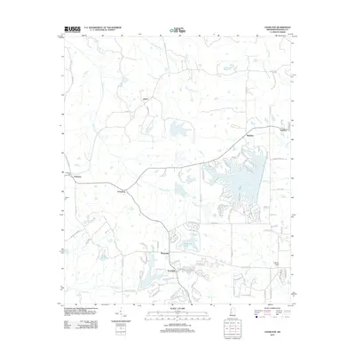
2012 Map of Charlton
USGS Topo · Published 2012About this map
Annandale and Mannsdale serve as central points in this Madison County landscape, where modern residential development increasingly defines the terrain between established rural settlements. The map illustrates a shift in land use, particularly visible around Stribling Lake and the complex network of suburban drives and boulevards like Northshore Blvd and Caroline Blvd. Amidst this growth, the area's history remains anchored by landmarks such as Anderson Cem and Jackson Cem. Waterways like Persimmon Cr and Panther Cr weave through the region, connecting smaller communities such as Stokes and Richton. This survey documents a transitional era where family-named cemeteries and older settlements like Livingston exist alongside new lakeside developments and golf courses, providing a detailed record of the county's evolving residential footprint.
Find a feature on this map
101 named features on this map. Tap any name to fly to it.
Don’t see what you’re looking for? This feature index may not catch every label — zoom into the map to look around manually.
Map Details
Editions of this 2012 Charlton Map
This is the sole edition of this map. No revisions or reprints were ever made.
Other maps of this area

1903 · Jackson
USGS Topo · 1:125,000

1905 · Jackson
USGS Topo · 1:48,000

1908 · Jackson
USGS Topo · 1:62,500

1934 · Raymond
USGS Topo · 1:48,000

1937 · Raymond
USGS Topo · 1:62,500

1942 · Raymond
USGS Topo · 1:62,500

1955 · Jackson
USGS Topo · 1:250,000

1961 · Jackson
USGS Topo · 1:250,000

1961 · Canton
USGS Topo · 1:62,500

1962 · Jackson
USGS Topo · 1:250,000