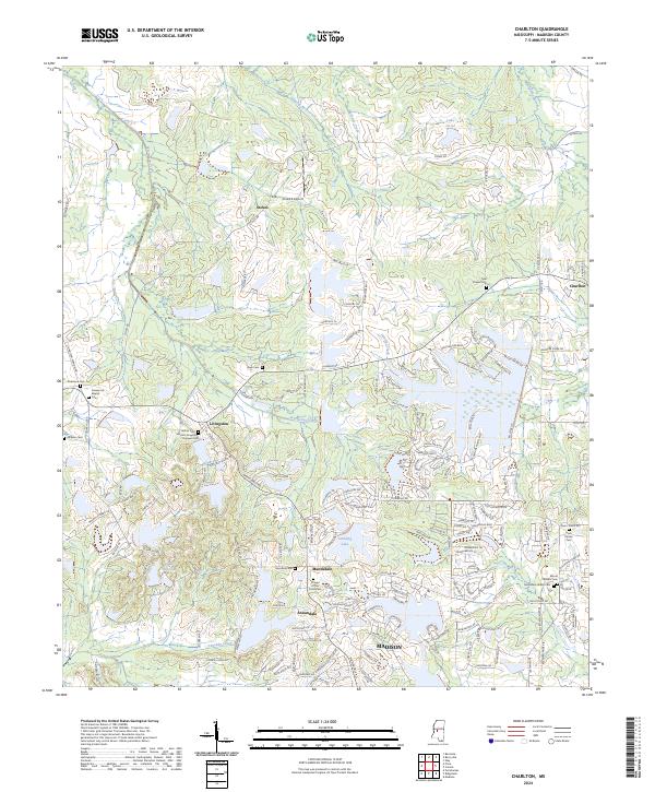
2024 Map of Charlton
USGS Topo · Published 2024About this map
Livingston and Mannsdale serve as focal points in this Madison County landscape, where the suburban expansion of Madison meets established rural holdings. The area is characterized by a dense concentration of small family and community burial grounds, such as the Hatten Cem Harrell-Livingston-Runnels Cem and the McMahon-Ridley Cem, reflecting long-standing genealogical ties to the land. This contemporary survey shows how modern residential developments like Annandale and Stonebridge are carved into the terrain between traditional watercourses like Persimmon Creek and Hanging Moss Creek. The presence of the Cloud 9 Airport near Stokes and the sprawling Stribling Lake further illustrate the mix of private aviation, recreation, and residential growth defining this part of Mississippi today.
Find a feature on this map
162 named features on this map. Tap any name to fly to it.
Don’t see what you’re looking for? This feature index may not catch every label — zoom into the map to look around manually.
Map Details
Editions of this 2024 Charlton Map
This is the sole edition of this map. No revisions or reprints were ever made.
Other maps of this area

1903 · Jackson
USGS Topo · 1:125,000

1905 · Jackson
USGS Topo · 1:48,000

1908 · Jackson
USGS Topo · 1:62,500

1934 · Raymond
USGS Topo · 1:48,000

1937 · Raymond
USGS Topo · 1:62,500

1942 · Raymond
USGS Topo · 1:62,500

1955 · Jackson
USGS Topo · 1:250,000

1961 · Jackson
USGS Topo · 1:250,000

1961 · Canton
USGS Topo · 1:62,500

1962 · Jackson
USGS Topo · 1:250,000