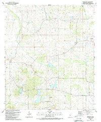
1988 Map of Charlton
USGS Topo · Published 1989About this map
Livingston and Mannsdale serve as central nodes in this rural landscape of Madison County, where small settlements are scattered across a terrain defined by winding creek basins and small impoundments. The 1980s landscape shows a transition toward leisure and residential developments, evidenced by the Golf Course near Annandale and multiple private reservoirs like Stribling Lake and Cedar Hill Lake. This era represents a period after several historic communities had consolidated around local institutions, such as Damascus Ch and the Mt Pleasant Ch.
Find a feature on this map
26 named features on this map. Tap any name to fly to it.
Don’t see what you’re looking for? This feature index may not catch every label — zoom into the map to look around manually.
Map Details
Editions of this 1988 Charlton Map
This is the sole edition of this map. No revisions or reprints were ever made.
Other maps of this area

1903 · Jackson
USGS Topo · 1:125,000

1905 · Jackson
USGS Topo · 1:48,000

1908 · Jackson
USGS Topo · 1:62,500

1934 · Raymond
USGS Topo · 1:48,000

1937 · Raymond
USGS Topo · 1:62,500

1942 · Raymond
USGS Topo · 1:62,500

1955 · Jackson
USGS Topo · 1:250,000

1961 · Jackson
USGS Topo · 1:250,000

1961 · Canton
USGS Topo · 1:62,500

1962 · Jackson
USGS Topo · 1:250,000