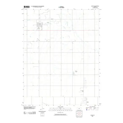
2009 Map of Chase
USGS Topo · Published 2009About this map
The town of Chase sits at the heart of this Rice County landscape, serving as a primary point of settlement along the gridded section roads of central Kansas. This 2009 survey highlights the region's enduring connection to the energy industry, notably through the Tobias Oil Field and the Tobias Northwest Oil Field to the southeast, along with an Oil Field Tank positioned west of the main town site. The map records important genealogical and community sites, including Saint Marys Cemetery on the southwestern edge of town and Springdale Cemetery to the northeast. The surrounding prairie is defined by the wandering paths of Spring Creek and Cow Creek, which break the strict geometry of the agricultural landscape. On the southern edge of the quadrangle, the private Schafer Airfield serves as a small aviation landmark amidst the rural expanses.
Find a feature on this map
24 named features on this map. Tap any name to fly to it.
Don’t see what you’re looking for? This feature index may not catch every label — zoom into the map to look around manually.
Map Details
Editions of this 2009 Chase Map
This is the sole edition of this map. No revisions or reprints were ever made.
Other maps of this area

1894 · Lyons
USGS Topo · 1:125,000

1955 · Great Bend
USGS Topo · 1:250,000

1957 · Great Bend
USGS Topo · 1:250,000

1958 · Great Bend
USGS Topo · 1:250,000

1967 · Alden
USGS Topo · 1:24,000

1967 · Alden NW
USGS Topo · 1:24,000
1967 · Sterling
USGS Topo · 1:24,000

1970 · Lyons
USGS Topo · 1:24,000
1970 · Chase NE
USGS Topo · 1:24,000
1970 · Raymond
USGS Topo · 1:24,000