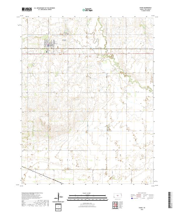
2022 Map of Chase
USGS Topo · Published 2022About this map
Chase serves as the central hub of this Rice County survey, showcasing a grid of streets including Main St and Sunderland St. The surrounding landscape is defined by the steady flow of Spring Creek and Cow Creek, which wind through the agricultural sections. For those researching local families, the map identifies key burial sites such as Saint Mary's Cemetery located south of the main town and Springdale Cemetery to the northeast. The geography is organized by a meticulous network of roads, with 7th Road through 13th Road providing access to the vast farm tracts. The transition between township boundaries like t19s r9w and t20s r9w illustrates the systematic division of the Kansas prairie, where the natural watercourses remain the most prominent relief against the human-imposed grid.
Find a feature on this map
33 named features on this map. Tap any name to fly to it.
Don’t see what you’re looking for? This feature index may not catch every label — zoom into the map to look around manually.
Map Details
Editions of this 2022 Chase Map
This is the sole edition of this map. No revisions or reprints were ever made.
Other maps of this area

1894 · Lyons
USGS Topo · 1:125,000

1955 · Great Bend
USGS Topo · 1:250,000

1957 · Great Bend
USGS Topo · 1:250,000

1958 · Great Bend
USGS Topo · 1:250,000

1967 · Alden
USGS Topo · 1:24,000

1967 · Alden NW
USGS Topo · 1:24,000
1967 · Sterling
USGS Topo · 1:24,000

1970 · Lyons
USGS Topo · 1:24,000
1970 · Chase NE
USGS Topo · 1:24,000
1970 · Raymond
USGS Topo · 1:24,000