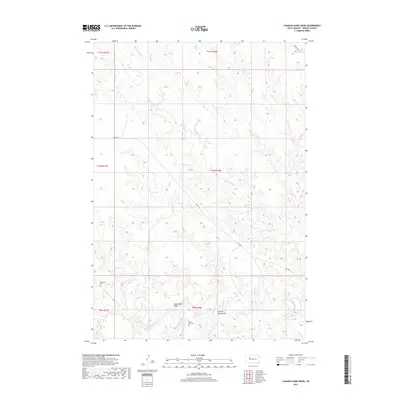
2017 Map of Chasing Hawk Draw
USGS Topo · Published 2017About this map
Chasing Hawk Draw and Dead Horse Draw define the drainage patterns of this rural Ziebach County landscape, where deep-cut coulees and creeks form a complex network across the prairie. The map captures a section of the Cheyenne River Reservation near the southern border of District 2, revealing a pattern of remote ranching and tribal lands. Cultural sites are focused around water and transit, including the Saint Pius Cem and Eaglestaff Cem, which serve as important landmarks for genealogical research in this sparsely populated region. The importance of seasonal water management is evident at K C Dam, while the primary transit artery, Bia Hwy 6, cuts diagonally across the terrain to connect disparate homesteads. Stream systems like Cherry Cr and Red Scaffold Cr dominate the topography, illustrating the erosive force of water on the South Dakota plains.
Find a feature on this map
20 named features on this map. Tap any name to fly to it.
Don’t see what you’re looking for? This feature index may not catch every label — zoom into the map to look around manually.
Map Details
Editions of this 2017 Chasing Hawk Draw Map
This is the sole edition of this map. No revisions or reprints were ever made.
Other maps of this area

1953 · Rapid City
USGS Topo · 1:250,000

1954 · Pierre
USGS Topo · 1:250,000

1957 · Rapid City
USGS Topo · 1:250,000

1958 · Pierre
USGS Topo · 1:250,000

1982 · Chasing Hawk Draw
USGS Topo · 1:24,000

1982 · Dead Horse Draw
USGS Topo · 1:24,000

1982 · Bull Creek 2 NE
USGS Topo · 1:24,000

1982 · Bridger NE
USGS Topo · 1:24,000

1982 · Bessie Butte
USGS Topo · 1:24,000

1982 · Red Scaffold
USGS Topo · 1:24,000