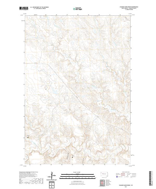
2021 Map of Chasing Hawk Draw
USGS Topo · Published 2021About this map
Saint Pius Cem and Eaglestaff Cem serve as vital genealogical anchors in this prairie landscape within the Cheyenne River Indian Reservation. The map documents a complex drainage network where Red Scaffold Cr and Cherry Cr dominate the southern and central sections, joined by seasonal flows through Dead Horse Draw and Chasing Hawk Draw. Human interaction with this arid environment is evidenced by the K C Dam and the path of Bia Hwy 6, which provides the primary transit route through these expansive grasslands. The map's layout of section lines and township markers, including t10n r18e, illustrates the enduring structure of land management in Ziebach County. Researchers can trace the intersections of historic tribal land use and federal surveying, observing how natural features like Little Mud Cr and Turtle Cr dictate the placement of local infrastructure.
Find a feature on this map
20 named features on this map. Tap any name to fly to it.
Don’t see what you’re looking for? This feature index may not catch every label — zoom into the map to look around manually.
Map Details
Editions of this 2021 Chasing Hawk Draw Map
This is the sole edition of this map. No revisions or reprints were ever made.
Other maps of this area

1953 · Rapid City
USGS Topo · 1:250,000

1954 · Pierre
USGS Topo · 1:250,000

1957 · Rapid City
USGS Topo · 1:250,000

1958 · Pierre
USGS Topo · 1:250,000

1982 · Chasing Hawk Draw
USGS Topo · 1:24,000

1982 · Dead Horse Draw
USGS Topo · 1:24,000

1982 · Bull Creek 2 NE
USGS Topo · 1:24,000

1982 · Bridger NE
USGS Topo · 1:24,000

1982 · Bessie Butte
USGS Topo · 1:24,000

1982 · Red Scaffold
USGS Topo · 1:24,000