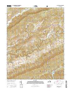
2016 Map of Chatham Hill
USGS Topo · Published 2016About this map
Chatham Hill serves as a central hub in this Appalachian landscape, where the North Fork Holston River carves a path through the ridge-and-valley topography of Smyth and Tazewell counties. The settlement pattern is defined by dispersed mountain hamlets such as Tannersville, Ridgedale, and Ellendale, connected by historic routes like the Blue Grass Trl and Old Wilderness Rd. This survey captures a terrain dominated by Brushy Mtn and Walker Mtn, with much of the land protected within the Jefferson National Forest.
Find a feature on this map
79 named features on this map. Tap any name to fly to it.
Don’t see what you’re looking for? This feature index may not catch every label — zoom into the map to look around manually.
Map Details
Editions of this 2016 Chatham Hill Map
This is the sole edition of this map. No revisions or reprints were ever made.
Other maps of this area

1887 · Pocahontas
USGS Topo · 1:125,000

1889 · Wytheville
USGS Topo · 1:125,000

1891 · Tazewell
USGS Topo · 1:125,000

1891 · Pocahontas
USGS Topo · 1:125,000

1891 · Abingdon
USGS Topo · 1:125,000

1892 · Wytheville
USGS Topo · 1:125,000

1894 · Pocahontas
USGS Topo · 1:125,000

1894 · Abingdon
USGS Topo · 1:125,000

1895 · Tazewell
USGS Topo · 1:125,000

1895 · Pocahontas
USGS Topo · 1:125,000