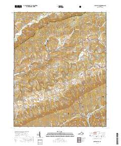
2019 Map of Chatham Hill
USGS Topo · Published 2019About this map
Walker Mtn and Brushy Mtn dominate this stretch of Southwest Virginia, carving out the narrow agricultural corridors of Freestone Valley and Rich Valley. The North Fork Holston River snakes through the center of the sheet, connecting small communities like Ellendale, Ridgedale, and Chatham Hill. The landscape is characterized by its numerous small family cemeteries and geographic depressions such as Bently Hole, reflecting a settlement pattern deeply tied to the specific topography of the ridge-and-valley system.
Find a feature on this map
81 named features on this map. Tap any name to fly to it.
Don’t see what you’re looking for? This feature index may not catch every label — zoom into the map to look around manually.
Map Details
Editions of this 2019 Chatham Hill Map
This is the sole edition of this map. No revisions or reprints were ever made.
Other maps of this area

1887 · Pocahontas
USGS Topo · 1:125,000

1889 · Wytheville
USGS Topo · 1:125,000

1891 · Tazewell
USGS Topo · 1:125,000

1891 · Pocahontas
USGS Topo · 1:125,000

1891 · Abingdon
USGS Topo · 1:125,000

1892 · Wytheville
USGS Topo · 1:125,000

1894 · Pocahontas
USGS Topo · 1:125,000

1894 · Abingdon
USGS Topo · 1:125,000

1895 · Tazewell
USGS Topo · 1:125,000

1895 · Pocahontas
USGS Topo · 1:125,000