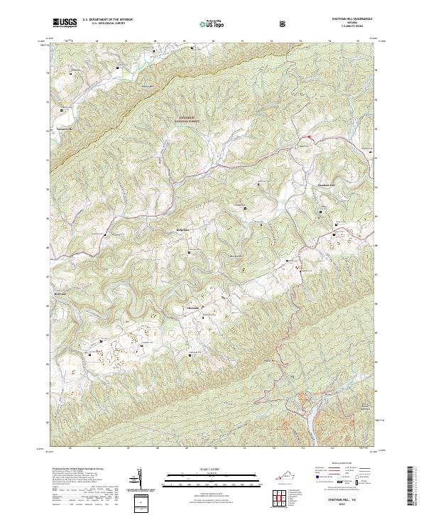
2022 Map of Chatham Hill
USGS Topo · Published 2022About this map
Chatham Hill and the surrounding Rich Valley define this landscape along the border of Tazewell and Smyth counties. The terrain is structured by the prominent parallel ridges of Brushy Mtn and Walker Mtn, with the North Fork Holston River cutting through the southwestern portion near Riverside. Small rural communities like Tannersville, Ellendale, and Ridgedale are connected by a network of local roads that follow the contours of the valleys and hollows. For family historians, the area is notably dense with small burial grounds including the Necessary Cem, Burnop Cem, and Richardson Cem, reflecting generations of settlement in these sheltered Appalachia valleys. Much of the high ground is protected within the Jefferson National Forest, preserving the wooded character of heights like Cove Ridge and the deep drainage of Locust Cove Cr.
Find a feature on this map
77 named features on this map. Tap any name to fly to it.
Don’t see what you’re looking for? This feature index may not catch every label — zoom into the map to look around manually.
Map Details
Editions of this 2022 Chatham Hill Map
This is the sole edition of this map. No revisions or reprints were ever made.
Other maps of this area

1887 · Pocahontas
USGS Topo · 1:125,000

1889 · Wytheville
USGS Topo · 1:125,000

1891 · Tazewell
USGS Topo · 1:125,000

1891 · Pocahontas
USGS Topo · 1:125,000

1891 · Abingdon
USGS Topo · 1:125,000

1892 · Wytheville
USGS Topo · 1:125,000

1894 · Pocahontas
USGS Topo · 1:125,000

1894 · Abingdon
USGS Topo · 1:125,000

1895 · Tazewell
USGS Topo · 1:125,000

1895 · Pocahontas
USGS Topo · 1:125,000