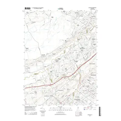
2014 Map of Chatham
USGS Topo · Published 2014About this map
The Passaic River meanders across this northern New Jersey landscape, serving as a natural boundary between Morris, Union, and Somerset counties. The area is characterized by the prominent ridges of First Watchung Mtn and Second Watchung Mtn, which frame the suburban development of the early 21st century. High-density residential clusters and research hubs like Murray Hill and Berkeley Heights sit alongside large protected green spaces and cemeteries, reflecting the region's long-standing transition from rural estates to a sophisticated suburban corridor. Genealogists will find a high concentration of burial sites, ranging from the historic N Plainfield Burying Ground to the expansive Saint Teresa Cem and Saint Mary's Roman Catholic Cem. The inclusion of unique planned communities like Free Acres and established neighborhoods like Homestead Park illustrates the diverse social and residential history of the Watchung Mountains region.
Find a feature on this map
352 named features on this map. Tap any name to fly to it.
Don’t see what you’re looking for? This feature index may not catch every label — zoom into the map to look around manually.
Map Details
Editions of this 2014 Chatham Map
This is the sole edition of this map. No revisions or reprints were ever made.
Other maps of this area

1888 · Plainfield
USGS Topo · 1:62,500

1888 · Morristown
USGS Topo · 1:62,500

1888 · Lake Hopatcong
USGS Topo · 1:62,500

1891 · Somerville
USGS Topo · 1:62,500

1893 · Plainfield
USGS Topo · 1:62,500

1893 · Somerville
USGS Topo · 1:62,500

1894 · Morristown
USGS Topo · 1:62,500

1894 · Lake Hopatcong
USGS Topo · 1:62,500

1898 · Lake Hopatcong
USGS Topo · 1:62,500

1898 · Morristown
USGS Topo · 1:62,500