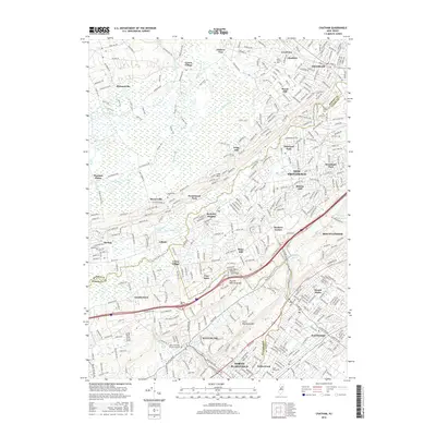
2016 Map of Chatham
USGS Topo · Published 2016About this map
The Great Swamp dominates the northwestern portion of this 2016 survey, its drainage fed by Black Brook, Great Brook, and Paunaka Brook. This wetland expanse contrasts sharply with the dense residential corridors of Chatham and New Providence, which follow the path of the Morris & Essex RR. To the south, the topography is defined by the prominent ridges of First Watchung Mtn and Second Watchung Mtn, creating a natural barrier that influenced the settlement patterns of North Plainfield and Watchung.
Find a feature on this map
175 named features on this map. Tap any name to fly to it.
Don’t see what you’re looking for? This feature index may not catch every label — zoom into the map to look around manually.
Map Details
Editions of this 2016 Chatham Map
This is the sole edition of this map. No revisions or reprints were ever made.
Other maps of this area

1888 · Plainfield
USGS Topo · 1:62,500

1888 · Morristown
USGS Topo · 1:62,500

1888 · Lake Hopatcong
USGS Topo · 1:62,500

1891 · Somerville
USGS Topo · 1:62,500

1893 · Plainfield
USGS Topo · 1:62,500

1893 · Somerville
USGS Topo · 1:62,500

1894 · Morristown
USGS Topo · 1:62,500

1894 · Lake Hopatcong
USGS Topo · 1:62,500

1898 · Lake Hopatcong
USGS Topo · 1:62,500

1898 · Morristown
USGS Topo · 1:62,500