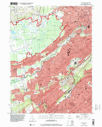
1995 Map of Chatham
USGS Topo · Published 2000About this map
The Great Swamp National Wildlife Refuge and the Watchung Mountains define this landscape where Morris, Somerset, and Union Counties meet. By the mid-1990s, the area shows a dense network of suburban development and preserved lands, centered on the Passaic River corridor. The map details established neighborhoods in Chatham and New Providence, while preserving the footprints of older institutional sites like the John E Runnells Hospital and St Josephs Shrine.
Find a feature on this map
94 named features on this map. Tap any name to fly to it.
Don’t see what you’re looking for? This feature index may not catch every label — zoom into the map to look around manually.
Map Details
Editions of this 1995 Chatham Map
This is the sole edition of this map. No revisions or reprints were ever made.
Other maps of this area

1888 · Plainfield
USGS Topo · 1:62,500

1888 · Morristown
USGS Topo · 1:62,500

1888 · Lake Hopatcong
USGS Topo · 1:62,500

1891 · Somerville
USGS Topo · 1:62,500

1893 · Plainfield
USGS Topo · 1:62,500

1893 · Somerville
USGS Topo · 1:62,500

1894 · Morristown
USGS Topo · 1:62,500

1894 · Lake Hopatcong
USGS Topo · 1:62,500

1898 · Lake Hopatcong
USGS Topo · 1:62,500

1898 · Morristown
USGS Topo · 1:62,500