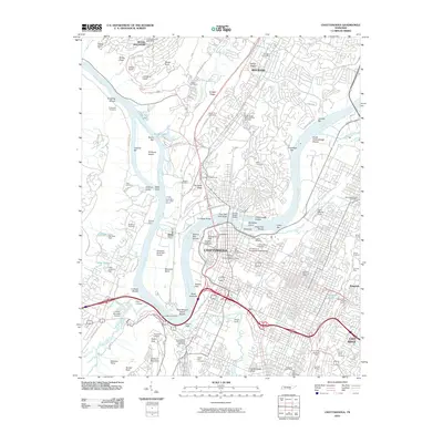
2010 Map of Chattanooga
USGS Topo · Published 2010About this map
Moccasin Bend anchors the center of this 2010 topographic record, where the Tennessee River makes its famous deep loop around the northern tip of Lookout Mountain. The urban core of Chattanooga is densely detailed, showing the civic layout from the Golden Gateway to the riverfront, including the University of Tennessee Chattanooga campus. Historical and cultural landmarks are abundant, including the Cravens House on the slopes of the mountain and the Old Stone Church Tower near the downtown district.
Find a feature on this map
128 named features on this map. Tap any name to fly to it.
Don’t see what you’re looking for? This feature index may not catch every label — zoom into the map to look around manually.
Map Details
Editions of this 2010 Chattanooga Map
This is the sole edition of this map. No revisions or reprints were ever made.
Other maps of this area

1886 · Ringgold
USGS Topo · 1:125,000

1888 · Chattanooga
USGS Topo · 1:125,000

1892 · Ringgold
USGS Topo · 1:125,000

1893 · Chattanooga
USGS Topo · 1:125,000

1935 · East Chattanooga
USGS Topo · 1:24,000

1935 · Daisy
USGS Topo · 1:24,000

1935 · East Ridge
USGS Topo · 1:24,000

1936 · Ketner Gap
USGS Topo · 1:24,000

1936 · Hooker
USGS Topo · 1:24,000

1936 · Fort Oglethorpe
USGS Topo · 1:24,000