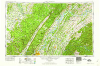
1959 Map of Chattanooga
USGS Topo · Published 1959About this map
Chattanooga serves as the focal point for this mid-century look at Southeast Tennessee, where the Tennessee River snakes through the high ridges of the Cumberland Plateau and Walden Ridge. The landscape is dominated by the Tennessee Valley Authority's massive hydroelectric projects, including the wide expanses of Chickamauga Lake, Watts Bar Reservoir, and Fort Loudoun Reservoir. This era captures the region's complex infrastructure of major rail lines like the Southern Ry and Louisville & Nashville RR alongside expanding federal highways.
Find a feature on this map
117 named features on this map. Tap any name to fly to it.
Don’t see what you’re looking for? This feature index may not catch every label — zoom into the map to look around manually.
Map Details
Editions of this 1959 Chattanooga Map
This is the sole edition of this map. No revisions or reprints were ever made.
Other maps of this area

1886 · Dalton
USGS Topo · 1:125,000

1886 · Cleveland
USGS Topo · 1:125,000

1886 · Knoxville
USGS Topo · 1:125,000

1886 · Ringgold
USGS Topo · 1:125,000

1886 · Stevenson
USGS Topo · 1:125,000

1886 · Dahlonega
USGS Topo · 1:125,000

1887 · Kingston
USGS Topo · 1:125,000

1888 · Ellijay
USGS Topo · 1:125,000

1888 · Chattanooga
USGS Topo · 1:125,000

1888 · Scottsboro
USGS Topo · 1:125,000